Turkey: Coruh Extreme 2006

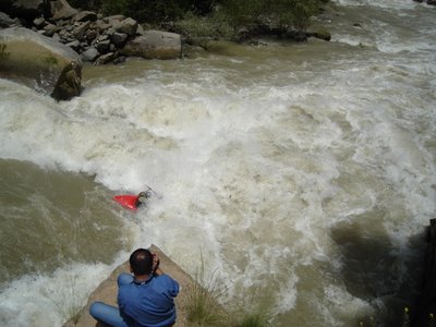
The first week of june Dave Manby organised his 2nd annual Extreme event on the Coruh-river in the north-eastern part of Turkey. The event started in Ispir and finished in Yusufeli, 110 km downstream. A mass-start, an individual down-river-race and a slalom on the Bahal-river were on the program, with participants from the USA, England, Iran and Belgium.
The event was won by Belgian Pro-team paddler Steven Van den heuvel (paddling the new-XENO), ahead of Amir Hussein from Iran. The event was the perfect way to explore the Coruh-river! Thank you Dave!!!

Steven Van den heuvel enjoys
check: www.coruhextreme.com
THE
Section: Bayburt to Artvin
Difficulty: V+ in high water
Season: May to August.
Length: Bayburt - Ispir
Ispir - Yusufeli 110
Yusufeli - Artvin
Character: Remote, though not a wilderness trip as a road runs along side for most of its length.
The North East corner is a rugged and inaccessible area. Alexander the Great by-passed the region, the
Though Bayburt is sometimes used as the put-in most trips, hungry for the rapids, start a short way upstream of the little
Many of the rapids on the Çoruh have been named, but because of their frequency and the fact that they have been named by independent groups much time can be spent working out whether a particular rapid is "Minister's rapid" and if so is it the same rapid as "The Stud". In 1991 the Minister of Tourism joined a white water festival rafting down the river and took a lengthy swim at the rapid that now bears his name. This rapid also happens to form one of the "Joan Collins Set", which are the first five major rapids that arrive within 15kms. of Ispir; "Joan", dark and mysterious is followed by "Alexis", pleasant but can turn nasty.
"The Bitch" is self explanatory and is followed by "Dynasty" (sometimes spelt by a dyslexic as dysentery) and finally "The Stud". At high water these are an awesome set of rapids almost merging into each other and will leave even the world-weary expert impressed.
After this opening assault , the river eases and at normal rates of river running it still provides one or two major rapids and an almost endless stream of class III rapids each day till Yusufeli is reached. Along this stretch castles are easily seen perched on the rocks above the river and others can be spotted if you know where to look. These make great off-river excursions though the castle at Tekkale (
The Bahal river, which is a pleasant class III for both rafts and kayaks from Sarigol down and a class V kayak (only) run upstream of Sarigol, joins the Çoruh at Yusufeli. Even if you decide not to run the river this valley is well worth an explore. The alpine meadows and wooded hills make for a pleasant change from the stark brown banks of the Çoruh. Lepidopterists and ornithologists often visits these high altitude pastures looking for butterflies and the rare red hawk and other birds. Brown bears still inhabit the region but are rare now. Expeditions to
Down the Çoruh more rapids await the paddler along with the river's biggest challenge. Care should be taken as the river is now hemmed in by steep banks and rock cliffs and it is easy to career down the river arriving above a rapid and be committed to running it as the portage would be almost impossible (especially with laden rafts). The Çoruh's biggest rapid, know as "King Kong" or "Lava East" or "House Rock" or "Aslam" depending on whose name you select is one such rapid and is usually portaged in high water. Another problem on this lower stretch is rock falls. New rapids appear or alterations to existing rapids occur to confuse the regular runner. By Zeytinlik the river is slowing and the rapids less frequent. The last 20kms to Artvin are flat.
The Çoruh's water level drops dramatically through the season as the snow melts. During the summer rain is a rarity on this side of the mountains and what may fall is seldom enough to affect the river level to any large degree. In early May any idea of paddling the river for pleasure is ridiculous, I have seen the top of the rock in "House Rock" covered, but by the end of August in all but the biggest snow pack years the notion of floating a raft on some stretches is challenging in a different way. Early June can be depended on to give one of the finest multi-day white water trips anywhere in the world with the longest flat water stretch being no more than around eight kilometers.
Planning a trip to the Çoruh? Consider being there for the second week in June and visit the Kafkasor festival at Artvin: bull fighting and wrestling along with folk dancing and exhibitions of local handicraft. Take a tent and stay the night. The bull fighting is nothing like Spanish bull fighting; it is bull against bull and the wrestling is Karakucak wrestling, similar to the wrestling of


<< Home